1960’s
Geological Survey of Canada conducts an airborne magnetic survey over the Property at 800 metre spacing


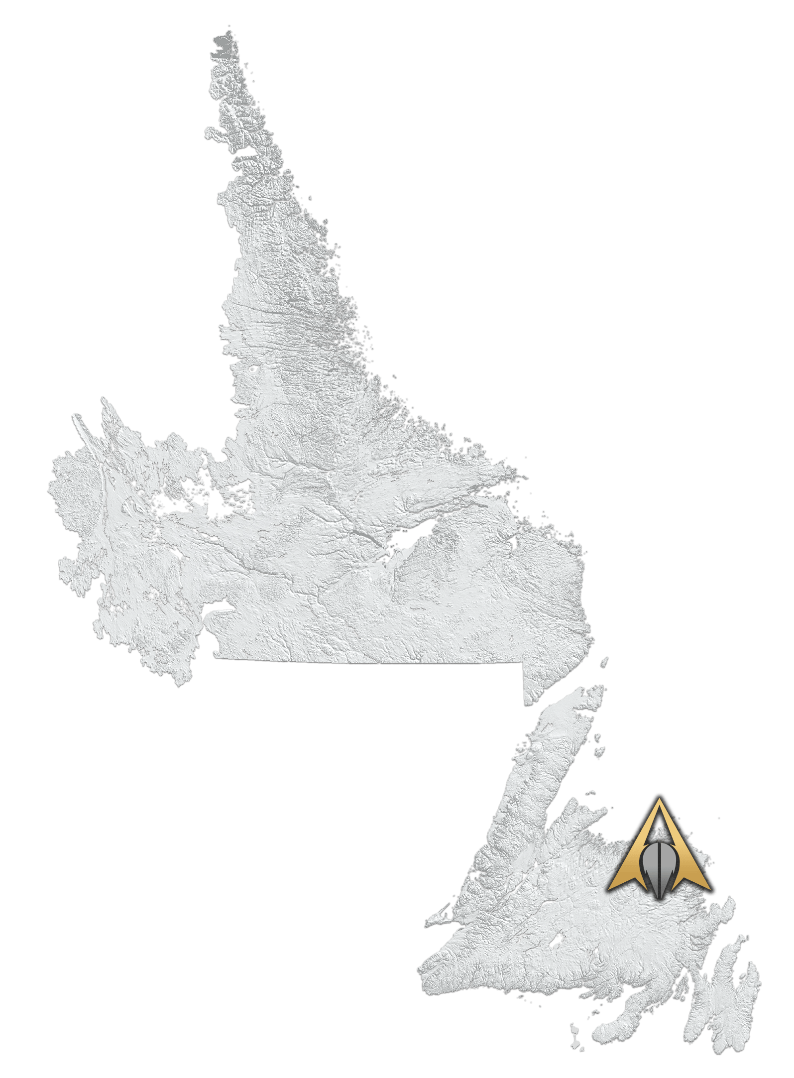
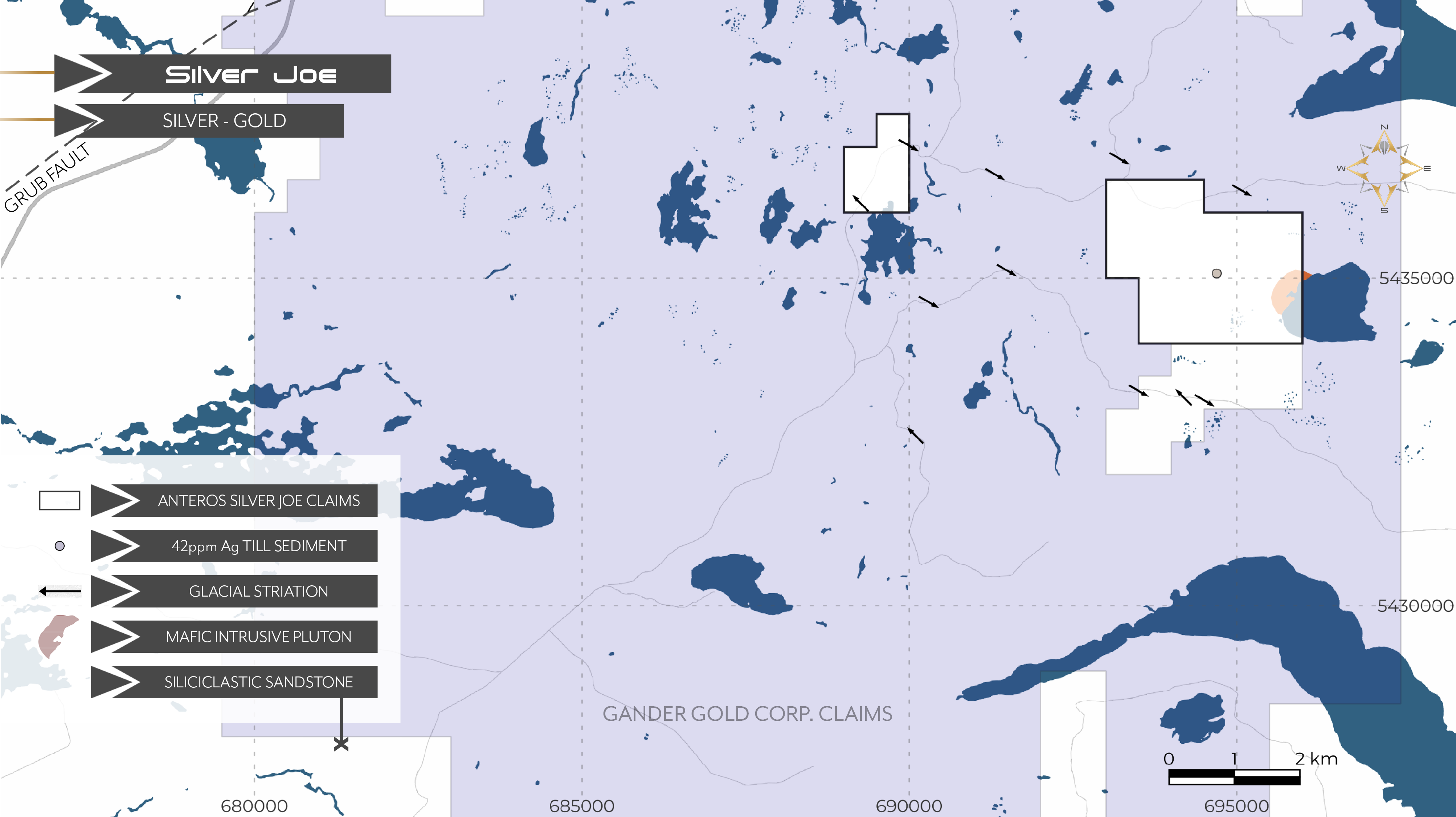


The Silver Joe Project is located in the Gander Group of sediments adjacent the newly emerging Gander Gold Camp, including the New Found Gold Corp Keats Zone discovery, and Gander Gold Corp.’s Gander North Project. The road-accessible Project is 100% owned by Anteros Metals, and consists of 30 claims over two distinct, non-contiguous claim blocks: the Traverse Water Property, and the main Silver Joe Property. The Properties run parallel to the Keats Zone hosted GRUB fault; it is also near a zone of Gander Gold Corp.’s Au soil anomalies within their recently identified gold trend proximal to the GRUB line.

Central Newfoundland is comprised of the Ganderia Terrane, which is subdivided into the Gander Lake and Exploits Subzones by the Gander River Ultramafic Belt (GRUB) and associated parallel fault systems termed the JBP and Appleton Faults. Rocks of the Exploits (Dunnage) Zone consist of volcanic, volcaniclastic and sedimentary rocks of island-arc and back-arc affinity interpreted to represent remnants of the Iapetus Ocean. The Gander Zone consists of psammitic and semipelitic metasedimentary rocks from a continentally derived sedimentary wedge. Rocks of the Exploits Subzone were thrust onto the Gander Zone contemporaneous with the Taconian Orogeny.
The New Found Gold Corp. Queensway Project high-grade gold discoveries are along the contact of these subzones.
The Silver Joe Property lies within the Jonathan’s Pond Formation of the Gander Lake Subzone and consists of a variety of clastic and chemical sedimentary rocks, and mafic to felsic rocks. Exposures of gabbro and granite in the Wing Pond area are associated with the Wing Pond Shear Zone. Silver Joe has similar mafic intrusive rocks occurring on the west side of Hungry Pond.
The Gander Gold Belt is delineated by a parallel series of north-south trending faults, hosting substantial Au deposits. From east to west spanning approximately 30 kilometres, the trends comprise the Dog Bay Line, Appleton Fault, JBP Fault, and the GRUB line, and host New Found Gold Corp.’s Queensway Project. Silver Joe lies just east of the GRUB line within this fault zone.
Twelve kilometres east of the GRUB line lies a potential newly-uncovered gold trend. It is approximately 25 kilometres east of high-grade discoveries made by New Found Gold and Labrador Gold on the Appleton Fault. Major lineaments from this new trend run parallel to and transect the Silver Joe Project while the most significant clusters of geochemical Au anomalies reported by Gander Gold Corp. on the potential trend lie near the Project.
Shear zones within the Jonathan’s Pond Formation (e.g., Wing Pond) near the property host anomalous gold along with late mafic intrusive rocks. The Silver Joe property hosts a similar mafic intrusion, along strike of other documented mafic rocks. Coupled with anomalous gold and silver found in till in recent government publications, the property immediate area is prospective for yet undiscovered fault systems for additional gold and silver mineralization.
1960’s
Geological Survey of Canada conducts an airborne magnetic survey over the Property at 800 metre spacing
1980
Newfoundland and Labrador Geological Survey Branch conducts lake sediment geochemical surveying
1987
Geological Survey of Canada conducts airborne magnetic‐radiometric‐EM surveying at 1,000 metre line spacing
1988
Newfoundland Department of Mines and Energy discovers the Wing Pont Aug showing, some 6 kilometres to the east of the current Property
2010
Newfoundland and Labrador Geological Survey Branch conduct regional till sampling in the area of the Property returning 29 ppb Au from the south end of the Property, and 41.8 g/t Ag from the central area
Geological Survey of Canada conducts an airborne magnetic survey over the Property at 800 metre spacing
Newfoundland and Labrador Geological Survey Branch conducts lake sediment geochemical surveying
Geological Survey of Canada conducts airborne magnetic‐radiometric‐EM surveying at 1,000 metre line spacing
Newfoundland Department of Mines and Energy discovers the Wing Pont Aug showing, some 6 kilometres to the east of the current Property
Newfoundland and Labrador Geological Survey Branch conduct regional till sampling in the area of the Property returning 29 ppb Au from the south end of the Property, and 41.8 g/t Ag from the central area